
Reviewed · COLUMBIA RIVER GORGE WATERFALL TOURS
Mount Hood & Columbia River Gorge Air Tour by Envi Adventures
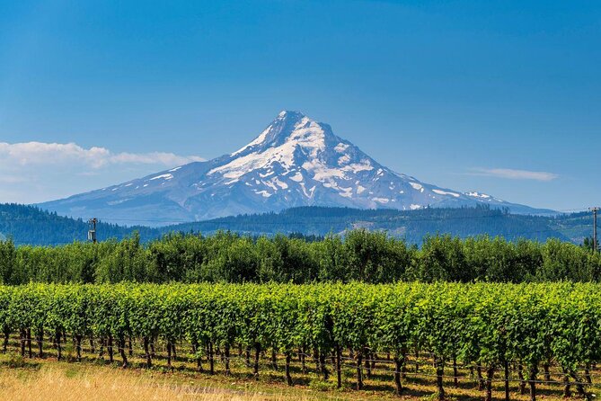
Mount Hood looks like a postcard from the ground. From the air, it’s more like a front-row seat. This small-group flight flies you up close to Oregon’s tallest peak and back through major Columbia River Gorge icons, timed for great photo angles.
I love how the plane keeps the experience personal, with a small group (max 5) and pilot commentary that helps you actually see what you’re looking at. You’ll also get a real mix of sights—volcano views, big river bends, and multiple falls. One thing to plan around: this tour is very weather dependent, and your route can change if conditions aren’t right.
In This Review
- Key things to know before you fly
- Why a 5-Seater Plane Flight Feels Better Than “Just Driving”
- Where the Tour Starts: Envi Adventures in Troutdale
- The Flight Pattern: Willamette Valley, Mount Hood, Then the Gorge Icons
- Willamette Valley: Getting Oriented Before the Big Peaks
- Mount Hood Close-Up: Wy’east Views and Volcano Details
- From Sandy River to Mount Hood National Forest: The Watershed Story
- Beacon Rock and Multnomah Falls: Geology You Can Actually See
- Beacon Rock
- Multnomah Falls (and why you get two looks)
- Bridge of the Gods and Latourell Falls: The Gorge in Sections
- Bridge of the Gods
- Latourell Falls
- Vista House and Crown Point: Seeing Why Everyone Stops Here
- Photo Tips for Mount Hood and the Gorge (In Real Aircraft Time)
- Weather Dependence: How to Think About Risk Without Stress
- Who This Tour Fits Best (and Who Might Rethink It)
- Should You Book This Mount Hood & Columbia River Gorge Air Tour?
- FAQ
- Is this tour actually a helicopter flight?
- How long is the Mount Hood and Columbia River Gorge air tour?
- What sights will I see during the flight?
- What happens if weather is bad?
- How many people are in the group?
- Where do I meet, and how early should I arrive?
Key things to know before you fly
- Small-group feel with a maximum of 5 travelers in the aircraft
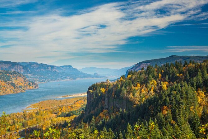
- Big photographic payoff: multiple gorge landmarks and a close approach to Mount Hood
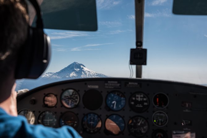
- Planes, not helicopters, so you’ll be in a compact 5-seater cabin setting
- Weather can change the route, since the pilot may reroute as needed
- A strong geology theme, from floods shaping rock formations to spring-fed waterfalls
More of the Gorge, waterfall by waterfall
- Multnomah Falls and Columbia River Gorge Half-Day Hiking Tour★ 5.0 · 2,108 reviews
- Columbia River Gorge Waterfalls Tour from Portland, OR★ 5.0 · 1,278 reviews
- Multnomah Falls and Columbia River Gorge Waterfalls Tour Morning★ 5.0 · 913 reviews
- Mt Hood Day Trip from Portland to Multnomah Falls and Hood River★ 5.0 · 695 reviews
Why a 5-Seater Plane Flight Feels Better Than “Just Driving”
If you’ve ever tried to see the Columbia River Gorge and Mount Hood in one day, you know the reality: it’s a lot of driving, and you’re always fighting for roadside angles. This tour flips the equation. You trade traffic for time in the air, where the entire Gorge shows its full shape at once.
The aircraft is an airplane with a small seating setup, not a helicopter. That matters. In a smaller plane, you get quicker sightlines to landmarks, and the pilot can point out what’s worth aiming your camera at. Several pilots (like JP, Corey, and Davis, based on past flights) are known for staying calm, keeping the ride smooth, and giving you useful context while you’re up there.
The other win: you’re not just looking at one view. The flight is built as a loop—up toward Mount Hood, then back through the Gorge with repeat sightings of major falls and viewpoints.
Where the Tour Starts: Envi Adventures in Troutdale
You’ll meet at Envi Adventures, 1350 NW Perimeter Way, Troutdale, OR 97060. The tour starts and ends at the same location, so you’re not juggling a shuttle or wondering where you’ll end up after landing.
Plan to arrive at least 30 minutes before your start time. In small-aircraft tours, that buffer helps you check in, handle any paperwork, and get settled without rushing. It’s also worth knowing the tour is offered in English and uses a mobile ticket.
One practical tip: if you’re coming from Portland, this start point is positioned so it’s reachable and not in the middle of nowhere. Still, give yourself time, because waiting around is easier than trying to sprint to a flight departure.
The Flight Pattern: Willamette Valley, Mount Hood, Then the Gorge Icons
This is roughly a one-hour experience, but the schedule is more like a planned route than a rigid script. In good conditions, you’ll follow the flight order that starts with the Willamette Valley, then moves toward Mount Hood, and then returns through the Gorge landmarks.
Here’s how that flow tends to feel from the passenger side:
- First, you ease into the region with a look over the Willamette Valley (about 30 minutes scheduled). This is a great warm-up segment because the land patterns are easier to read from above—fields, river corridors, and the way the terrain transitions.
- Next comes Mount Hood (about 15 minutes scheduled). This is the “big” moment, with the mountain close enough that it feels like you’re hovering near it.
- After that, you head toward the Sandy River area (about 5 minutes scheduled) and the Mount Hood National Forest (about 15 minutes scheduled), which gives you a sense of how the forested slopes feed into the watershed.
- Then the Gorge sightseeing kicks in with short, punchy passes—Beacon Rock, Multnomah Falls, the Bridge of the Gods, Latourell Falls, Vista House, and Crown Point—each giving you a quick but dramatic aerial angle.
Because the day can change, think of this tour as a “best-of” route. The pilot’s job is to use airspace and weather conditions to get you the most value possible.
Willamette Valley: Getting Oriented Before the Big Peaks
Starting with the Willamette Valley is smart, even if you think you’re just there for Mount Hood. From the air, the Valley gives you context fast. You begin to see how the land slopes, where rivers have cut through, and how the region transitions into more rugged terrain.
If you’re photographing, the Valley portion can be helpful because lighting is often more forgiving at the start of a flight. It’s also a good stretch for getting used to the aircraft, settling your camera, and deciding whether you prefer wide shots (for the overall pattern) or tighter framing (for the river and field edges).
A small drawback: if clouds form early, you might lose some of the finer detail over the Valley. That’s simply part of a weather-dependent tour, and it’s why having expectations tuned toward “what we can see” works better than aiming for a perfect checklist.
Still chasing the mountain? More Mount Hood runs
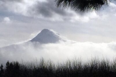
Mount Hood Close-Up: Wy’east Views and Volcano Details
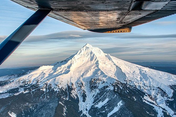
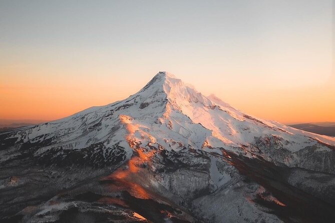
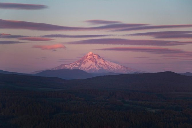
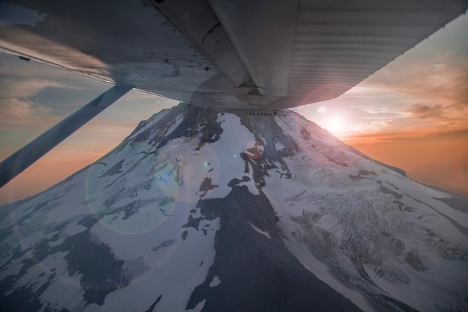
The main event is Mount Hood—known by the Multnomah tribe as Wy’east—and it’s treated like the star of the show. Geologically, it’s described as a potentially active stratovolcano in the Cascade Volcanic Arc, and the flight gives you a direct way to see how a major volcano dominates the region’s horizon.
Why that matters to you on the ground:
- Seeing Mount Hood from above helps you understand its scale. On a scenic road, you get a distant silhouette. In the air, you see the mountain’s mass and how the terrain wraps around it.
- A pilot can point out what you’re looking at, so you’re not just staring at snow and rock—you’re reading the shape.
You’ll get about 15 minutes scheduled near Mount Hood, and this is usually when you’ll want to slow down and let the mountain fill your frame. If conditions are clear, it’s the portion that can feel most unforgettable because the volcano looks like it belongs to a map lesson.
If conditions are rough and cloud cover shows up, you may still catch partial views. One rider noted that the pilot worked with cloud coverage so they could still see Mount Hood, which is a good reminder: the “best” view may come in fragments, but they still try to get it.
From Sandy River to Mount Hood National Forest: The Watershed Story
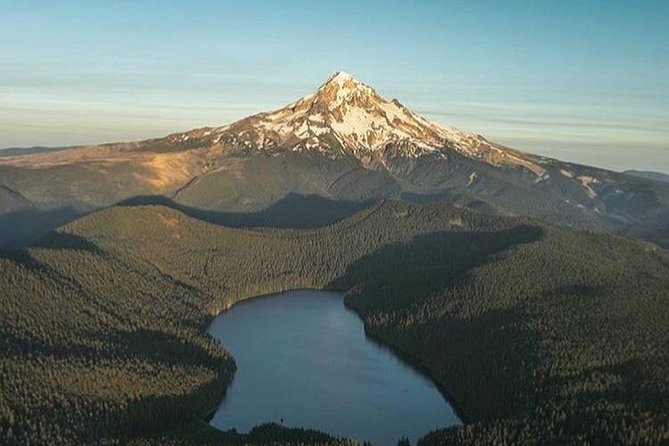
Next you trace the area around the Sandy River, a 56-mile tributary of the Columbia River. From the air, rivers like this do more than look scenic—they show you how water moves through the terrain.
Then you transition toward Mount Hood National Forest (about 15 minutes scheduled). This part is valuable because it explains the ecology in a practical way: forests sit on slopes and ridges that steer where streams form and where rivers run. It’s a different kind of sightseeing than a waterfall-only day.
Photography note: forests from above can look like texture more than “trees.” That’s not a problem. If you’re aiming for pattern and contrast, forested slopes often photograph beautifully because you’re capturing the way the terrain grades into the river corridor.
Beacon Rock and Multnomah Falls: Geology You Can Actually See
The Gorge section is where the tour earns its keep. You’ll pass by the dramatic, recognizable features that people talk about because they’re iconic on the ground—and even more striking from above.
Beacon Rock
Beacon Rock is described as the 57,000-year-old plug of a cinder cone, tied to what’s considered the Boring Lava Field. The Missoula Floods are credited with carving away the rubbly flanks, leaving a freestanding monolith that’s become a symbol of the Gorge.
From the air, this kind of geology is easier to grasp because you can see the shape as a standalone object against the river corridor. It helps you connect the “how” (flood carving) with what’s left (the tall monolith).
Multnomah Falls (and why you get two looks)
You’ll see Multnomah Falls with short aerial passes—appearing twice on the route. It’s called out as the most visited natural recreation site in the Pacific Northwest, with more than 2 million visitors each year.
Here’s the detail that’s especially useful for your expectations: the falls are fed by underground springs from Larch Mountain, and flow varies a lot. It’s usually highest in winter and spring, so if you fly in another season, it may look thinner than peak flow photos you’ve seen online.
The flight also frames Multnomah Falls as a geology learning moment, because the Gorge exposes effects of ancient flooding. From the air, you’re seeing the shape of the falls in relation to the gorge walls—often the part that’s hardest to understand from a single roadside viewpoint.
Bridge of the Gods and Latourell Falls: The Gorge in Sections
Between falls and viewpoints, you get classic “big structure” and “secondary waterfalls” that round out the story.
Bridge of the Gods
The Bridge of the Gods is a steel truss cantilever bridge spanning the Columbia River between Cascade Locks, Oregon, and Washington state near North Bonneville. Aerial views make it feel like part of a longer engineering puzzle, because you can see the river bend and how the crossing fits the corridor’s shape.
Latourell Falls
Latourell Falls sits along the Columbia River Gorge in Oregon, within Guy W. Talbot State Park. The Historic Columbia River Highway passes nearby, and in certain spots you can see the lower falls from the road. From the air, you don’t have to hunt for the angle—the falls are simply visible from above.
These short passes (each only about 2 minutes scheduled) can feel intense. You’ll want your camera ready, because the best shots come from quick timing—getting the framing before the aircraft moves on.
Vista House and Crown Point: Seeing Why Everyone Stops Here
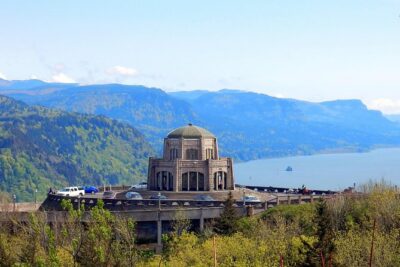
If you’ve heard of the Gorge’s most famous viewpoints, you’ll recognize this area: Crown Point State Park and the viewpoint where Vista House sits atop the cliffs.
The tour is designed to fly past the popular landmark (Vista House) and then include the Crown Point area as another aerial look. Even if you’ve never been there, from the air you’ll understand why people gather on those overlooks. The cliffs, river bends, and cliffline detail show you the Gorge’s layout in one glance.
One practical takeaway: viewpoint photography on the ground often means waiting for your turn with other people, or fighting for a spot. From the air, you bypass that bottleneck and get the bigger spatial context.
Photo Tips for Mount Hood and the Gorge (In Real Aircraft Time)
Aerial photography is half technique, half timing. This tour is built around short landmark passes, so here are practical ways to get better results without overcomplicating it:
- Use a fast check-in habit: camera ready before you reach the landmark. The Gorge icons are brief segments.
- Mix wide and medium shots: wide frames help show river bends and the mountain’s dominance; medium frames help you capture falls and monolith shapes like Beacon Rock.
- Expect clouds as a factor. Even if the forecast looks promising, mountain weather changes quickly. If you’re a little flexible, you’ll still come home with strong photos.
- If you’re motion-sickness prone, bring your usual plan. One rider said taking Dramamine helped them feel fine the whole ride—so if this is a concern for you, handle it ahead of time instead of hoping.
Also, pilots often help you line up shots. Several past flights praised how pilots kept it smooth and pointed out what to photograph. That means you don’t have to be an expert to get a solid set of images.
Weather Dependence: How to Think About Risk Without Stress
This is the main thing to respect: the operator notes the flight is very weather dependent and may result in an alternate route at the pilot’s discretion. In plain terms, if cloud cover or wind makes the planned path unsafe or impossible, you’ll pivot.
How to plan smart:
- Pick a day where you aren’t racing a tight schedule.
- If you’re hoping for a crystal-clear Mount Hood hero shot, understand that clouds can soften or block it—but pilots will still try to show you the best accessible views that day.
- Don’t assume a strict minute-by-minute guarantee. This tour is built around real conditions, not a pretend sky.
The good news from experience with this style of operation: pilots who fly these routes regularly tend to be good at adapting. You can feel that when rides stay smooth and commentary stays helpful even when visibility isn’t perfect.
Who This Tour Fits Best (and Who Might Rethink It)
I think this tour is ideal if you like:
- seeing big natural features fast (volcano + Gorge in one hour)
- getting a photographic angle that roads can’t provide
- a small-group experience where you can actually hear the pilot and track the scenery
It may be less ideal if:
- you’re very sensitive to motion and haven’t planned for it (though one rider reported Dramamine helped)
- you need a guaranteed, identical route no matter the weather
- you’re traveling with someone who can’t handle short, moving passes of multiple landmarks
A big practical check: weight limits matter on small aircraft. The tour lists a total weight per passenger of 250 lbs, and also includes group limits tied to the group size. You’ll need to provide passenger weights when booking so the flight can be safely planned.
Finally, it’s worth noting this is a tour that can be taken by most travelers, but children must be accompanied by an adult.
Should You Book This Mount Hood & Columbia River Gorge Air Tour?
If you want Mount Hood and the Gorge in one efficient hit—and you care about getting aerial perspectives you can’t easily replicate from the road—this is a strong choice. The best value is the combination: a close-in Mount Hood segment plus a return loop that hits major Gorge landmarks like Beacon Rock, Multnomah Falls (twice), Bridge of the Gods, and the Vista House/Crown Point cliff area.
I’d book it when:
- you’re flexible about weather and open to a possible alternate route
- you want photos and context from a pilot who talks through what you’re seeing
- you prefer small groups over crowded buses
I’d hesitate if:
- your schedule is too tight for a weather-dependent reroute
- you’re expecting a helicopter-style experience (this is an airplane)
- you don’t want to deal with the reality of mountain forecasts
If those trade-offs sound reasonable, you’ll likely leave with the kind of views that make the Gorge feel enormous—and Mount Hood feel close enough to touch, at least with your eyes.
FAQ
Is this tour actually a helicopter flight?
No. This experience is operated with airplanes, not helicopters.
How long is the Mount Hood and Columbia River Gorge air tour?
It’s about 1 hour (approx.), with the route planned as a sequence of shorter sightseeing segments.
What sights will I see during the flight?
You’ll fly over the Willamette Valley, then Mount Hood, the Sandy River area, Mount Hood National Forest, and Gorge highlights including Beacon Rock, Multnomah Falls (twice), Bridge of the Gods, Latourell Falls, plus the Vista House and Crown Point areas.
What happens if weather is bad?
The tour is very weather dependent and may result in an alternate route at the pilot’s discretion.
How many people are in the group?
The tour has a maximum of 5 travelers, in a small aircraft.
Where do I meet, and how early should I arrive?
Meet at Envi Adventures, 1350 NW Perimeter Way, Troutdale, OR 97060. Plan to arrive at least 30 minutes prior to the start time.
Portland From the Air, Encore
- Downtown Portland Air Tour by Envi Adventures
★ 5.0 · 93 reviews - Stunning Air Tour of the Columbia River Gorge by Envi Adventures
★ 5.0 · 84 reviews - Multnomah Falls Waterfall Air Tour by Envi Adventures
★ 5.0 · 39 reviews - Mt. St. Helens Air Tour by Envi Adventures
★ 5.0 · 39 reviews - Mt. Hood & Multnomah Falls Air Tour by Envi Adventures
★ 5.0 · 37 reviews
More Mount Hood Day Trips
- Mt Hood Day Trip from Portland to Multnomah Falls and Hood River
★ 5.0 · 695 reviews - Columbia River Gorge Waterfalls & Mt Hood Tour from Portland, OR
★ 5.0 · 585 reviews - Columbia Gorge Waterfalls and Mt. Hood Tour – Full Day
★ 5.0 · 339 reviews - Full-Day Mt Hood Waterfall Tour with Lunch and Wine Included
★ 5.0 · 205 reviews - Mt Hood, Waterfalls, and Wine Tour
★ 5.0 · 87 reviews
The Gorge, Three More Ways
- Multnomah Falls and Columbia River Gorge Half-Day Hiking Tour
★ 5.0 · 2,108 reviews - Columbia River Gorge Waterfalls Tour from Portland, OR
★ 5.0 · 1,278 reviews - Multnomah Falls and Columbia River Gorge Waterfalls Tour Morning
★ 5.0 · 913 reviews - Mt Hood Day Trip from Portland to Multnomah Falls and Hood River
★ 5.0 · 695 reviews - Columbia River Gorge Waterfalls & Mt Hood Tour from Portland, OR
★ 5.0 · 585 reviews
Just In: The Newest Portland Tour Reviews




Columbia River Gorge Waterfall Tours, compared.
 ★ 5.0Multnomah Falls and Columbia River Gorge Half-Day Hiking TourFrom $732,108 reviews
 ★ 5.0Columbia River Gorge Waterfalls Tour from Portland, ORFrom $891,278 reviews
 ★ 5.0Multnomah Falls and Columbia River Gorge Waterfalls Tour MorningFrom $85913 reviews
 ★ 5.0Mt Hood Day Trip from Portland to Multnomah Falls and Hood RiverFrom $133695 reviews
 ★ 5.0Columbia River Gorge Waterfalls & Mt Hood Tour from Portland, ORFrom $149585 reviews
 ★ 5.0Afternoon Half-Day Multnomah Falls and Columbia River Gorge Waterfalls Tour from PortlandFrom $85473 reviews
 ★ 4.5Portland Sightseeing Tour Including Columbia Gorge WaterfallsFrom $165423 reviews
 ★ 5.0Columbia Gorge Waterfalls and Mt. Hood Tour – Full DayFrom $129339 reviews
Browse the lists this tour appears in